 Dr. William Anderson
A UTD fluid dynamics expert helped propose a solution to a Martian mystery of how the planet Mars’ distinctive crater mountains formed.
Dr. William Anderson, an assistant professor of mechanical engineering in the Erik Jonsson School of Engineering and Computer Science, co-wrote a paper with Dr. Mackenzie Day, then a doctoral student at UT Austin, that was published in Physical Review E.
The paper explains the common Martian phenomenon of a mountain positioned downwind from the center of an ancient meteorite impact zone.
Gale Crater was formed by meteorite impact early in the history of Mars, and it was subsequently filled with sediments transported by flowing water. This filling preceded massive climate change on the planet and introduced the arid, dusty conditions that have been prevalent for the past 3.5 billion years. This chronology indicates wind must have played a role in sculpting the mountain.
“On Mars, wind has been the only driver of landscape change for over 3 billion years,” said Anderson, a Fellow, Eugene McDermott Professor. “This makes Mars an ideal planetary laboratory for wind-driven movement of sediment and dust. We’re studying how Mars’ swirling atmosphere sculpted its surface.”
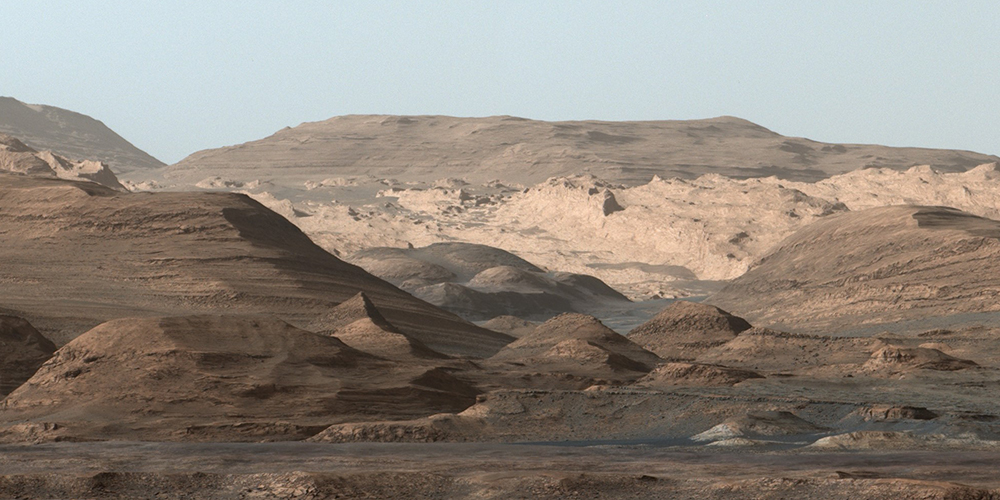
Wind vortices blowing across the crater slowly formed a radial moat in the sediment, eventually leaving only the off-center Mount Sharp, a 3-mile-high peak similar in height to the rim of the crater. The mountain was skewed to one side of the crater because the wind excavated one side faster than the other, research suggests.
Day and Anderson have shown via computer simulation that, given more than a billion years, Martian winds were capable of digging up tens of thousands of cubic kilometers of sediment from the crater — largely thanks to turbulence, the swirling motion within the wind stream.
The location — and mid-latitude Martian craters in general — became of interest as NASA’s Curiosity rover landed in 2012 in the Gale Crater, where it has gathered data since then.
The theory Anderson and Day tested via computer simulations involves counter-rotating vortices (think of horizontal dust devils) spiraling around the crater to dig up sediment that had filled the crater in a warmer era, when water flowed on Mars.
Simulations have demonstrated that wind erosion could explain these geographical features, offering insight into Mars’ distant past, as well as context for the samples collected by Curiosity. This understanding of the long-term power of wind can be applied to Earth as well, although there are more variables on our home planet than Mars, Anderson said.
 A photo taken by NASA’s Curiosity rover looking toward the higher regions of Mount Sharp. (Photo courtesy of NASA/JPL-Caltech/MSSS)